SkyDeck
Civil Aviation Building | Restriction | System
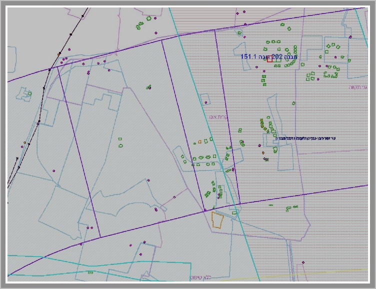
Urban planing and buliding permits monitoring system around airports, runways and airways.
In compliance with ICAO/FAA regualations.

What Is The System About?

-
18 years of service in ICAA (Israel Civil Aviation Authority)
-
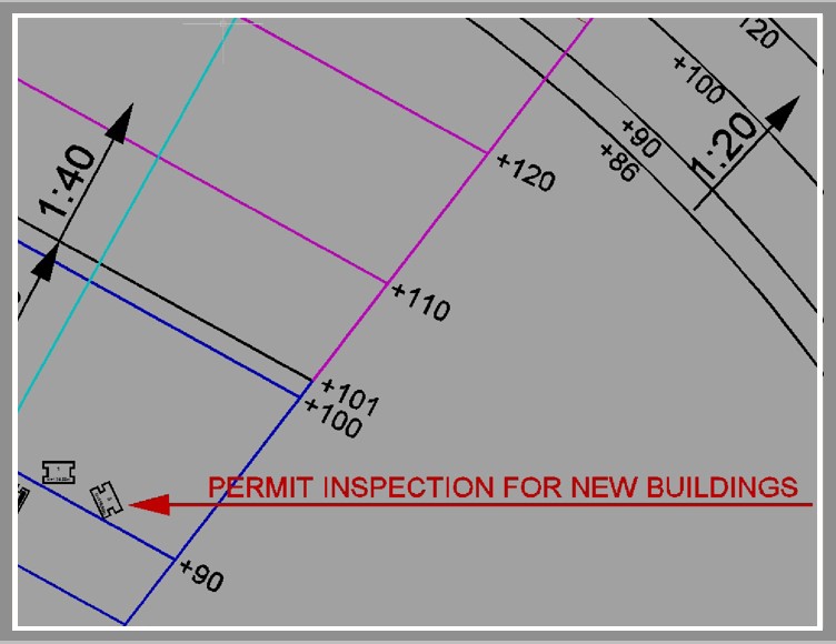
Building permits monitoring around airports, runways and airways
-
Urban planning
-
Control and monitor UAVS in civil airspace
-
Compliance with ICAO/FAA regulations
System Goals
Flight Safety
Controls and restricts the environment near airports, runways and low altitude flight path to ensure the highest level of the flight safety.
Urban planing Work
Planning and building permits tracking system adjacent to civil aviation restriction area.
Process Optimization
- Automation and optimization of plans review process
- Documents and schemes production
- Permits and other response production to the general public building applications
Unified Database
- Flight GIS information
- Up to date obstacle database
- Expose GIS API to external use
General Feature
GIS
Advance GIS visualition based on latest technology.
GEO
Centralize Geodatabase.
Manage
Advance user and system management.
UI/UX
Web and rich client developed utilizing advanced technology for high level usability.
Secured
System security compling with the highest standarts.
3D
Advance 3D visualition.
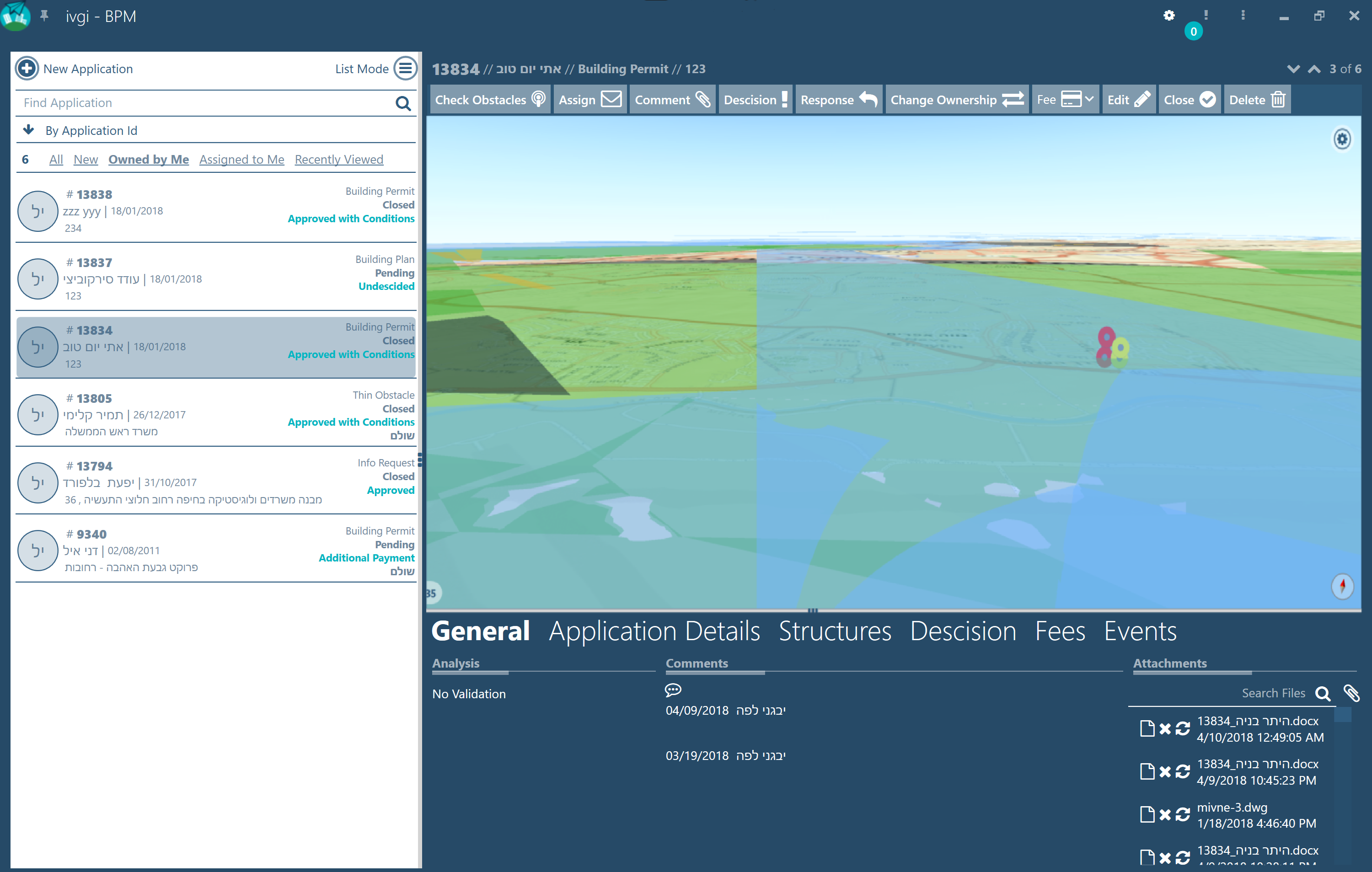
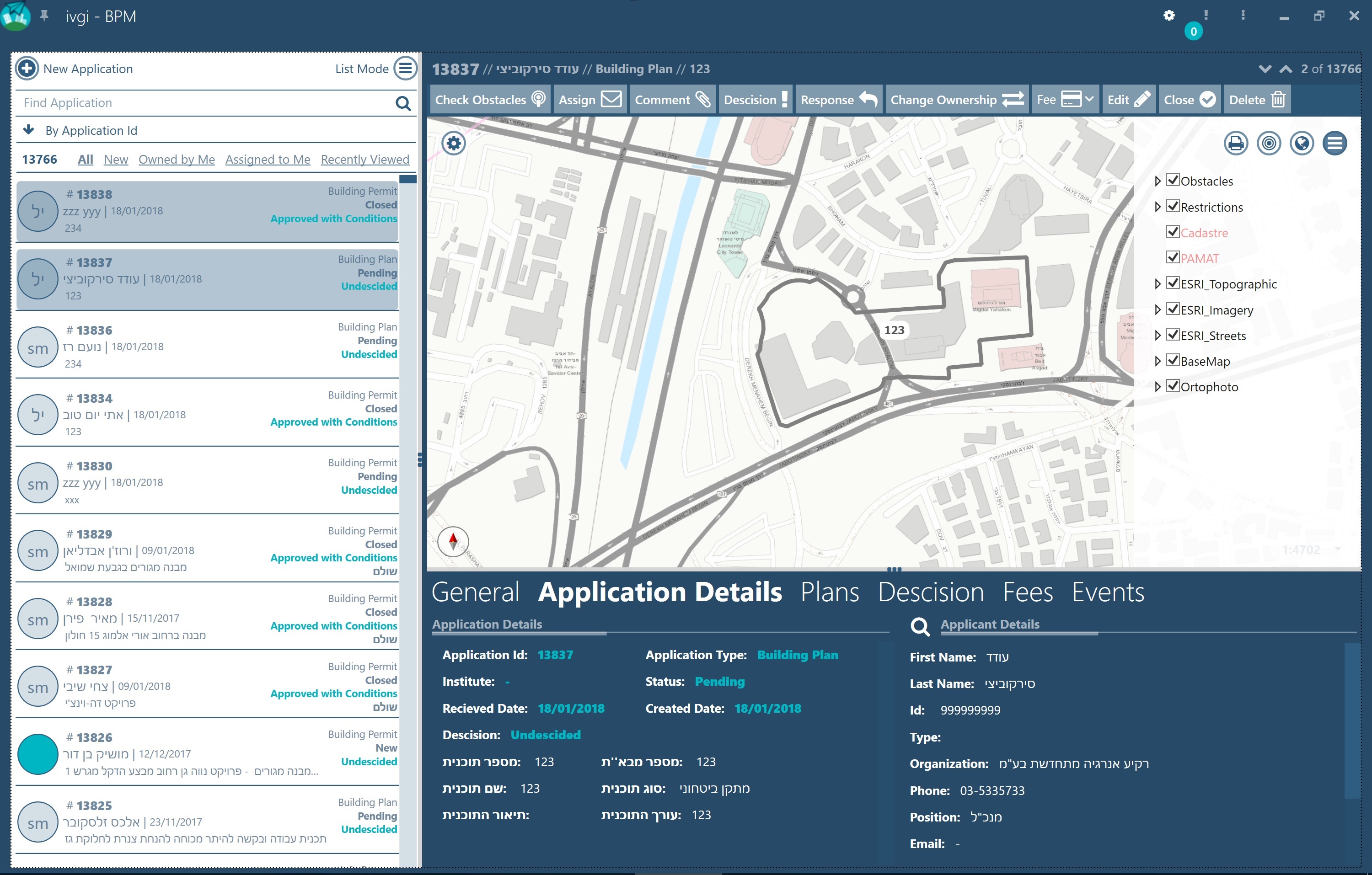
Public Application Management
Public building applications creation
Events management during the application time span
Client response management
Tools for geodata queries and system reports production
Testing Criteria
Height restriction
Noise zones restriction
Bird zones restriction
Obstacle prohibition clearways
Pre-Planning Information
Provide vital restriction information to the structure planner
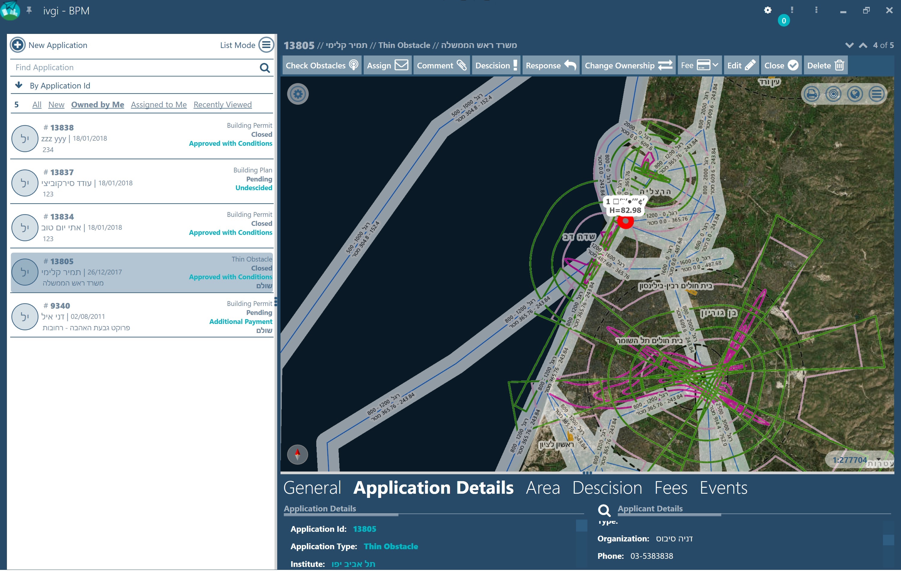
Obstacles Types

Building permits

Town plans and land use coverage

High voltage electricity pillars and cables

Narrow obstacle

Long objects
Output Automation
Geographical information
- Obstacles
- Aerial information publication
- Checkout Page
- Engineering information
Application and permit information for applicants
Use a built-in counter to check out how many events are planned for a certain date. This feature will help you keep track of your everyday activities.
DWG output file to engineers
Checked element printout
Support Input Formats
Support 3D input from multiple file formats: AutoCAD (.dwg .dxf), Microsoft Excel (.xlsx .xls), ESRI (ArcSDE .shp), Google (.kml)
Manual input option
Can connect to custom external API
Decistion Making Tools